
 Generalize Tool
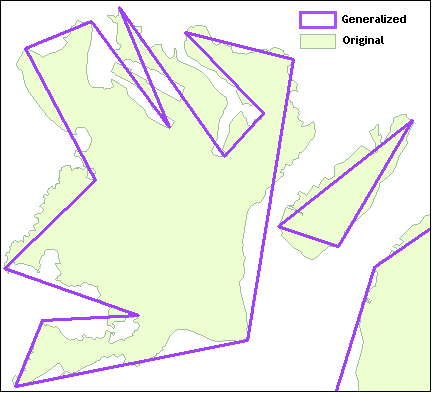
Decrease the number of nodes that make up a polygon or polyline, making a simpler rendition of the original spatial object. Polygons are generalized using the Ramer-Douglas-Peucker algorithm.
Configure the tool
- Specify the Spatial Field that contains the spatial object to be generalized.
- Specify the Threshold, default is 0.1.
- Specify the Units of the threshold, default is miles.
- Preserve Consistency for Entire Layer: Selected by default. Line segments that are shared by multiple objects are generalized at once, ensuring no gaps or overlaps occur between those objects.
Include in Output: Users can choose whether or not to include the original spatial object in the output stream. The default is unchecked so the object is not included.
Every node on the original line will be within this specified threshold of the generalized line.