Make Grid Tool
The Make Grid tool takes a specified spatial object (point or polygon ) and creates a grid based on the spatial object. The resulting grid is either a single grid, bound to the extent of the input spatial objects, or individual grids that dissect each input polygon.
Configure the tool
- Choose the Spatial Object Field: to build a grid from. The list contains both point type or a polygon objects.
- Specify the Grid Size and the units of the grid, which can be in Miles or Kilometers.
- Select the type of grid to make:
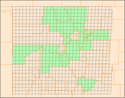
Generate Single Grid for Entire Layer: A single grid is created to the extent of the spatial objects (green polygons) in one layer. You could also use a point object for this type of grid.
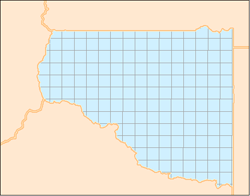
Generate Grids for Each Object A grid is created for each spatial object in the layer (blue polygon) and covers the extent of that object. You can only create this type of grid using polygon spatial objects
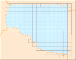
By checking Clip to Polygons, the grid is cut to the boundary of the polygon used to create the grid.